GPS4Golf
For Android · US$9.99, once
Find out how far you really drive it — on the course, not on the range. Tap Mark on the tee, tap Mark where the ball stopped, and the distance goes into your round.
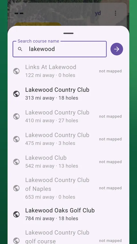
Read this before buying. GPS4Golf works in the United States only — its maps come from U.S. public imagery services. Course layouts come from OpenStreetMap, a volunteer-built map: many U.S. courses are there, not all, and some are missing tees or holes. Search for your course in the app first; if it is not mapped you can still play by marking each green as you reach it. Distances come from the phone's GPS, typically good to 5–10 yards under open sky — a guide, not a laser rangefinder.
Your real drive, not the one you remember
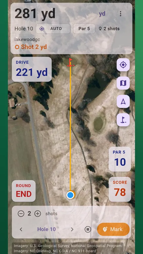
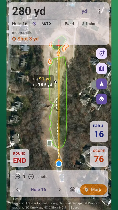
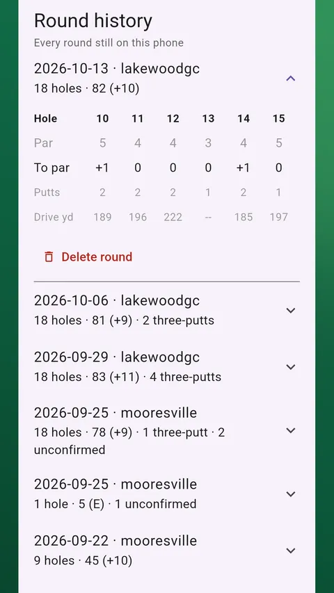
Two taps per hole. Mark where you hit from, walk to the ball, Mark again. The app measures the distance between the two points and keeps it with the hole, so at the end of the round you have your longest and average drive from shots you actually played.
Forgot to Mark the tee?
The app notices when your first Mark of a hole is far from the tee and offers to add the tee shot. On par 4s and 5s a swing detected at the tee can fill it in for you, with Undo.
Distance to the green
Live from where you stand, on satellite or topo maps. The app follows you from hole to hole and keeps tracking with the screen off and the phone in your pocket.
Score as you go
Count strokes during the hole and putts at hole-out. OUT, IN and total against par, and your shot, score and course files export as CSV or GeoJSON.
One purchase, and that is the end of it
US$9.99, paid once. Google Play converts that into your own currency, so the figure on the store page may not match to the cent.
- No advertising anywhere in the app.
- No subscription and no premium tier.
- No account — there is nothing to sign in to.
Your rounds stay on your phone
Your location and round records are stored on the phone and never sent to us. There is no analytics. The app uses location only while it is open or a round is running, and it does not ask for “Allow all the time”. A notification shows whenever it is using your location.
Questions
Does it work outside the United States?
No. The maps and satellite imagery come from U.S. federal and state public imagery services, which do not cover other countries. Courses in U.S. territories such as Puerto Rico and Guam are generally not available either.
Is my course in the app?
Possibly — search for it in the app before you rely on it. Course maps come from OpenStreetMap, built by volunteers. Many U.S. courses are mapped, but not all, and some have greens without tees or holes missing. If yours is not there you can still play: start without course info and mark each green as you reach it.
How accurate are the distances?
As accurate as the phone's GPS, which is typically 5–10 yards with a clear view of the sky and worse under heavy tree cover. Good for knowing your drive went 220 rather than 250; not a laser rangefinder.
Does it count my putts?
You enter them by count when you hole out. GPS cannot tell a 3-foot putt from a 10-foot one, so the app does not pretend to measure them.
Can I start on the back nine, or play only nine?
Yes. Starting on hole 10 or playing nine holes works the same as a full round.
Is my location sent anywhere?
No. See the privacy policy, which sets out exactly what stays on the phone.
What you need
An Android phone running Android 7.0 or later with GPS, and a golf course in the United States.
Course data © OpenStreetMap contributors, available under the Open Database License (ODbL). OpenStreetMap is a trademark of the OpenStreetMap Foundation; GPS4Golf is not affiliated with or endorsed by it. Imagery: U.S. Geological Survey, USDA NAIP and state imagery programs, each credited on the map. Google Play and Android are trademarks of Google LLC.